
Joan Roig Ribas.
1. Introduction.
This archaeological excavation was made during the second fortnight of April 2012 for to control the construction of a building at n# 36 Vía Púnica St. (Municipality Ciutat d'Eivissa).
Excavations at Vía Punica 34, adjacent site, in 2008 (Llinàs, Marí, 2009: 79-86) [i], warned us about the archaeological casuistry. During these works were found a total of 48 burials (in simple pit and cist) from 3rd and 4th centuries AD, a channel (late of 1st and full 2nd century AD) and a wall that marked a path to the south (post quem 2nd century BC). So, we expected to find in our site the continuity of these elements to the west, and, indeed, were confirmed, but we could refine some of the conclusions outlined in the previous excavation (Fig. 1).

Fig 1. General picture from the site.
2. Necropolis.
We detected a total of 13 burials (12 burials and 1 cremation), but unlike what reported for the excavation in Vía Púnica 34, here we establish two distinct phases. This idea has made possible with the diachronic physical relationships: two graves (T-11 and T-13) were sectioned and covered by the tombs that we assigned to necropolis phase of 3rd-4th centuries AD. So, we have an earlier stage that we ascribe to 2nd century AD due to the appearance, in their fillings, of potteries from african production type clear A.
- Phase 2nd century AD.
T-11 (figs. 2-6).
SU (stratigraphic unity) -39: it was the cover of the tomb. It was a set of five limestone blocks, although moved, showing faces worked (35x30x20cm). Its orientation was 65° 59'E NG and the upper bound of 3.69 m.a.s.l (meters above sea level).
SU-44: simple burial pit carved into the rock (SU-13). In its middle was sectioned by the grave T-5. The form was rectangular with the extreme southwest rounded. The length was 86cm, and 36cm for wide and deep. The section seemed to show a morphology in U, being wider at the top -60cm in height 3.69 m.a.s.l- and it was strangled at the bottom -36cm to 3.34-. Its orientation was 65° 59'E NG. The upper bound stood at 3.52 and 3.16 m.a.s.l the lower.
SU-45: it's the tomb of the deceased. He was in the supine position, the orientation of the trunk was 65 º 59'E NG, being the skull at the southwest and looking the face to the north with the jaw closed. The humeri remained in anatomical position, with elbows flexed and forearms were on the abdomen. The individual was sectioned by T-5 at the height of the diaphysis of the femurs, staying only their proximal epiphysis, even so, we could determine its anatomical position and strict articulation with the pelvis. Through various anthropological evidence could guess that it was an adult female. To do this we rely on:
- Age: Adult.
Metric: 290mm right humerus, left humerus preserved 260mm and overall length 70cm.
Completed epiphyseal fusion.
Eruption of the 3rd molar tooth (no. 48).
- Gender: Female.
Pelvis with an sciatic notch with obtuse angled.
Skull without occipital prominence.
In the filling appeared three iron nails on the extreme southwest of the tomb which undoubtedly belonged to the now-defunct wooden sarcophagus. We also emphasize that the individual was wearing a bronze bracelet on left humerus. About the potteries, we found various annular bases of ARSW (african red slide ware) -A that we associate to carinated bowls, probably like type Hayes 14 (2nd century AD).

Fig. 2. Remains of the cover T-11.

Fig. 3. Skeleton of the tomb n# 11.

Fig. 4. Detail of the bronze bracelet on left humerus.

Fig. 5. Detail of the iron nails on the extreme southwest of the tomb.

Fig. 6. Physical relationship between T-5 and T-11.
T-13 (figs. 7-9).
SU-48:
SU-49:
At first we thought it might be a primary incineration (bustum) as the inner walls of the pit had a clear flushing. But the outcrop of the skeleton, articulated and without signs of roasting, opens two new hypotheses:
a) Or is a child burial that reuses a previous incineration.
b) Or, could have done a combustion to make the walls tougher and subsequently removing the ashes.
In anyway, it seems clear that was an ignition inside the pit.
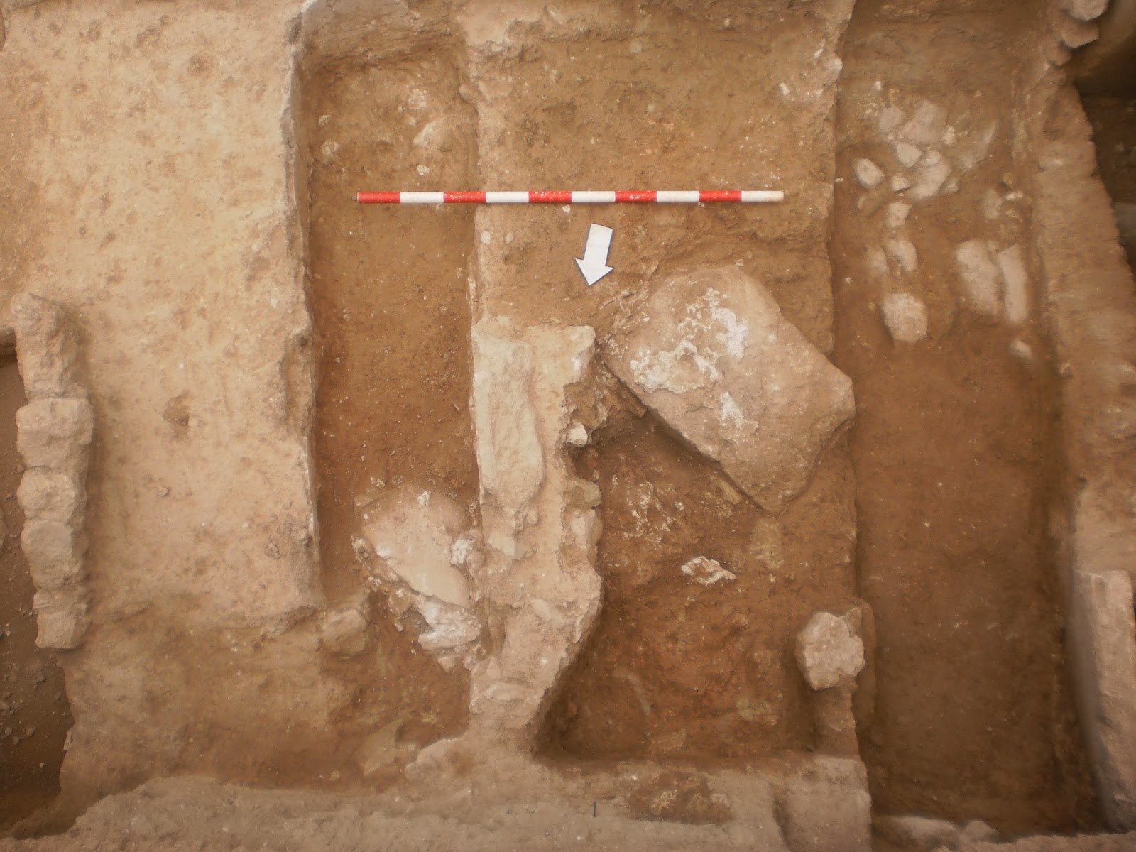
Fig. 7. Cover of tomb n# 13 under the structural elements of T-4.

Fig. 8. The child skeleton at the T-13.

Fig. 9. Relationship of the T-13 with T-8 (top) and T-4 (bottom).
- Phase 3rd-4th centuries AC.
T-1 (fig. 10).
SU-14:
SU-15: skeleton. Placed supine. The orientation of the trunk was 18 º 01'W NG, the skull was at north and looking its face to south with closed jaw. The upper bound, taken on the left knee, was at 3.58 m.a.s.l. The upper extremities were in anatomical position with forced bending of the elbows, forearms localized on the chest. The legs were in anatomical position with the knees extended. By the anthropological information done at the excavation, we can surmise, at this moment, and we are still waiting for the anthropological study by specialists, that it is a subadult individual of indeterminate sex. The criteria were:
- Metric: 200mm of left humerus, 260mm of right femur and total length of 1.19 m (without feet).
- Epiphyseal fusion and cranial synostosis were incompletes.
- No dental eruption of the third molars (pieces n# 18 and 48)
- Shortly tooth wear.
Under the head of the deceased, in the northwest corner, we could be found the remains of the cover of a new tomb; this was projected, from east to west, also under the adjacent T-2.

Fig. 10. Tomb n#1.
T-2 (fig. 11).
SU-16:

Fig. 11. Tomb 2 (on right).
T-3.
SU-18: were the structural elements of the tomb. Two rows parallel to the sides surrounded the grave and filled the pit made on SU-11: 2nd century AD deposit (dated with african cooking potteries), it was at north of the channel SU-8 and was cut by all tombs of the necropolis in its phase 3rd-4th centuries AD. Its dimensions were 1.14 m lenght, 30cm wide and 33cm deep. Orientation was NG 24 º 01'W. Judging by the measures, it must be a burial for a child, a fact that could explain the disappearance of the remains of skeleton. In its fill (SU-19) was found an ointment glass. The upper bound stood at 3.79; lower on 3.36 m.a.s.l.
T-4 (figs. 12-14).
SU-20:
US-21: skeleton. Placed supine. The trunk was oriented 14 º 01'W NG, located the skull on south and face looking to north with jaw closed. The arms had anatomic position; elbows were slightly bent and hands had a dorsal view. The forearms were placed on the abdomen and hands were crossed on the pelvis. The legs were also in anatomical position with knees extended. By information extracted of the anthropological preview, we could determine that it was a subadult individual of indeterminate sex. We are based on the following criteria:
- Metric: 200mm of right humerus, 300mm of right femur, 290mm of left femur and total length of 1.07 m (without feet).
- Epiphyseal fusion and cranial synostosis were incompletes.
- Dental Eruption: missing pieces to emerge 23 and 43.
- No excessive tooth wear.
In the filling were located seven iron nails that were circling the deceased, surely these ones were part of the wooden coffin. The upper bound, taken in the skull, was 3.60 m.a.s.l.

Fig. 12. Tomb n# 4.

Fig. 13. Detail of crossed hands on the pelvis and the iron nails on both sides of the skeleton.

Fig. 14. In this detail picture you can see one tooth in the maxilla (n# 23) that isn't emerged.
T-5 (figs. 15-17).
SU-22: cist. Its measurements were: 2m of length, 40cm of internal width and 80cm total and the maximum depth was of 68cm. Orientation was NG 15 º 01'W. The masonry was made with limestone blocks (35/40x30x20cm) locked with clay mortar. The joints hovered between 2 and 4cm of wide. The interior walls were configurated in opus incertum. The southeast corner was carved into the bedrock (SU-13), the northwest in stratum SU-11; we found masonry on both extremes. The interior walls was plastered with a lime mortar, ceramic crushed and gravel of quartzite and calcite. This tomb was cutting, as already mentioned, the tomb n# 5. In the northwest wall, we could detect a small loculus (20x20x20cm) who contained a piriform ointment of glass and a bronze punic coin, and them, certainly, were part of the funerary equipment. The topographic measurements were on 3.82 and 3.14 m.a.s.l, upper and lower respectively.
SU-23: skeleton. Placed supine. The trunk was oriented 15 º 01'W NG with skull located on south and the face looking on north with jaw unarticulated. The arms were in anatomical position, slightly bent on right elbow and in extension on left. The right forearm was on the abdomen and the left was parallel to body. The phalanges and metacarpals of both hands were disarticulated. The legs were in anatomical position with knees extended. The upper bound, taken on the skull, was on 3.29 m.a.s.l. With anthropological information collected in field, we determined that it was a young adult female. To do this we rely on the followings criteria:
- Age: Adult.
Metric: 260mm of right humerus, left humerus of 270mm, 390mm of right femur, 400mm of left femur and total length 1.55 m.
Epiphyseal fusion and cranial synostosis were completed.
Eruption of the third molar (n# 38).
Little tooth wear.
- Gender: Female.
Pelvis with sciatic notch in angle obtuse.
On the left forearm had a skull of an animal of indeterminated species (it could be a turtle shell). On her feet we found two snaps or buckles of black glass with golden nails; we interpreted them as ornaments of shoes made with some perishable material (probably leather). During the anthropological study of the remains appeared inside the skull a gold ring (http://iboshimarcheology.blogspot.com.es/2013/02/gold-ring-appeared-in-t-5-of-necropolis.html). Probably due to the inner scroll by a taphonomic process, surely, originally was deposited for rituals reasons, inside the mouth or on one eye.

Fig. 15. Tomb n# 5.

Fig. 16.

Fig. 17. The buckles of glass paste.
T-6 (fig. 18).
SU-25: cist. Its measurements were: length 1.92 m and 2.16 m, inner and outer respectively, inner width in the northwest corner was of 37cm, in the medial part of 40cm and 41cm at the southeastern extreme, the depth was 53cm in northwest corner, 45cm at the medial part and 47cm in the southeast. Its orientation was 12 º 01'W NG. The tomb was made with masonry of limestone blocks (47x26x10cm/25x25x10cm) with faces worked, they were locked with clay mortar and (in the joints) with small slabs. The east and west walls preserved up to three rows of masonry. The interior wall was plastered with lime mortar with binders made with ceramic crushed, limestone gravel and calcite nodules. In the southeast corner was where the coating was preserved better. In this tomb appeared no iron nails, it's possible that its smooth finished didn't require the presence of a sarcophagus. The topographic measurements were located on 3.62 and 3.06 m.a.s.l, upper and lower respectively.
SU-26: skeleton. Supine position. The trunk was oriented 12 º 01'W NG, skull was on south with face looking to north with jaw closed. The arms were in anatomical position, with elbows bent and hands with dorsal view. The forearms and hands were placed on the abdomen. The legs were in anatomical position with the knees extended. The upper bound, taken on the skull was of 3.14 m.a.s.l. By the anthropological information made on field, we could venture, initially, that it was an adult (mature) male. To do this we rely on the following criteria:
- Age: Adult.
Metric: 270mm of right humerus, idem for left humerus, 360mm of right femur and 370mm of left femur.
Great wear at the first molar of left quadrant of the jaw (n# 46).
- Sex: Male.
At the skull we detected a highly developed occipital crest and mastoid. The jaw had a great mental protuberance.
The sciatic notch of the pelvis drew a sharp angle.

Fig. 18. T-6.
T-7 (fig. 19).
SU-28: was an incineration pit carved in rock (SU-13). It seems that was a primary incineration (bustum) because the interior walls were burned. It had a rectangular form with rounded extremes. Its measurements were: 1.7 m of length by 50cm of width and 17cm of depth. Its orientation was 25 ° 01'W NG. The topographic measures were on 3.8 and 3.53 m.a.s.l, upper and lower respectively.
SU-12: it was the filling of ash of the incineration. It had a high content of carbon and was found so many charred bones.
It presented an similar orientation than the necropolis phase of 3rd-4th centuries AD, but, for its ritual, is difficult for us to establish it in this phase. Therefore we maintain some reservations about this tomb, although it could mean the survival of pagan rituals in later phases.
It presented an similar orientation than the necropolis phase of 3rd-4th centuries AD, but, for its ritual, is difficult for us to establish it in this phase. Therefore we maintain some reservations about this tomb, although it could mean the survival of pagan rituals in later phases.

Fig. 19. Bustum tomb n# 7 (bottom).
T-8 (figs. 20 y 21).
SU-29:
SU-30: skeleton. Supine position. The trunk was oriented 6 º 01'W NG. The skull was located on the south, looking the face on north and jaw was disarticulated. The arms were in anatomical position, with the right elbow in extension and the left in slightly bent. The right forearm was parallel to the body and left was on the abdomen. The legs were in anatomical position and with the knees in slightly bent. The upper bound, taken on the skull, was on 3.54 m.a.s.l. By the anthropological preview information, we believe that it was an adult male. To do this we rely on the following criteria:
- Age: Adult.
Metric: 300mm of right humerus, 290mm of left humerus, 454mm of right femur, 445mm of left femur and 1.66 m total length.
Dental eruption of the third molars (pieces n# 38 and 48; although the first one was lost, taphonomically, the socket remains unhealed in the jaw).
A dental wear.
- Sex: Male.
The skull showed: an abrupted occipital crest, a prominent mastoid and a big mentonian protuberance at the jaw.
Pathologies: Some teeth had caries (37, 41 and 47).
In the northwest corner appeared three iron nails that we associated to the coffin.
The jaw, right radius, sacrum and the phalanges and metacarpals of both hands were disarticulated by taphonomic processes.

Fig. 20. Tomb n# 8.

Fig. 21. Jaw, where you can see the tooth wear and eruption of the third molars.
T-9 (fig. 22).
SU-40:
SU-41: skeleton. Supine position. The trunk orientation was 8 º 01'W NG. The skull was located on south. Of the upper extremities were preserved only right laterality, appearing arm in anatomical position with the elbow extended. The right forearm was parallel to the body. The upper bound, taken on the left femur, was on 3.62 m.a.s.l. The legs were in anatomic position with knees extended. The anthropological information that we could extract was nil for the poor condition of the skeleton.

Fig. 22. Tomb n# 9.
T-10 (fig. 23).
This tomb could not be fully excavated because a part of it was under the north profile of the site.
SU-42: cist. Its measurements, that we could excavate, were: 45cm of lenght and 44cm of width. The digging was stopped at 22cm deep because physically was impossible to continue. Its orientation was NG N-S. The tomb was made with limestone blocks and locked with clay mortar. The interior walls had a plaster of lime mortar with limestone gravel and quartzite. The topographic measurements were on 3.69 and 3.47 m.a.s.l. (final of excavation), upper and lower respectively.

Fig. 23. Tomb n# 10.
T-12 (fig. 24).
SU-46: simple pit. Its measurements were: 1.14 m of lenght, 43cm of width and 10cm of depth. The orientation was 10 ° 01W NG. The form had anthropomorphic tendency. On north it was cutting the channel SU-8 and on south was leaning on the path wall SU-3. A phase of destruction or a hole that we could not determine, cut the left laterality of lower extremities of the skeleton and also its skull was sectioned. The topographic measurements were: 3.82 and 3.59 m.a.s.l, upper and lower respectively.
SU-47: skeleton. Supine position. The trunk was oriented on 10º01'W NG. The skull, although it wasn't there, it should have been located on north, looking its face to south (this one is the exception in the group with the T-1). The arms appeared in anatomical position (the left humerus was shifted to the feet of the skeleton by a taphonomic process) with right elbow flexed and the left slightly bent. Both hands had a dorsal view: the right over the abdomen and the left on the pelvis; the forearms were placed on the abdomen. The right leg was in anatomical position with the knee extended; the left leg was lost. The upper bound, taken on the right humerus, was on 3.76 m.a.s.l. Given the poor conditions of the skeleton we could not draw any conclusions from the anthropological information, but by the metric seems to be a subadult individual.

Fig. 24. Tomb n# 12.
3. Path (fig. 25).
This path acted as the backbone of all the structures and differents stages of the site. Its orientation was E-W, with 6.2m of length, 2.45m of the carriageway width and 3.15 m of total wide. Its constituent elements were:
- SU-2: cut on the rock that formed the southern flank of the path.
- SU-3: the north wall.
- SU-5: paved in the eastern section.
- SU-7: level of collapse or abandonment in the western section.

Fig. 25. The path.
SU-2: it was a
SU-3:
SU-5: it was the pavement or preparation of the path. It had a length of 10.6 m, width of 2.45 m and 20 cm of thick. Its orientation was E-W. It was made with limestone blocks and locked with yellow clay. The dimensions of the path also showed a decline to the west, and the maximum at the medial part was of 4.03, and the minimum, at the eastern extreme of the site, was of 3.86 m.a.s.l. At the west extreme we made a sampler excavation (1,45 x0, 75 m) where we extracted a thin wall ebusitanian pottery (-50/50). We also note the assumption that this can be a rudus level and not a circulation level.
SU-7: level of collapse or abandonment of the path. It was on the west extreme of the path. Had a maximum length of 4.6 m, 2.3 m of width and 28cm of thick. It consisted of large limestone blocks (35x25x17cm) and a fragment signinum. The topographic marks were located on 4.08 and 3.87 m.a.s.l, upper and lower respectively. Of its contents we extracted an edge of PE-25, a pivot of a PE-18 and an italian sigillata, that potteries gave us post quem horizons about second half of the 1st century AD.
4. Channel (figs. 26-28).
The channel (SU-8) had a length of 10.5 m, width of 14cm for the specus, and total of 54cm, and depth of 24cm. The orientation was 77 º 59'E NG. It was made with limestone masonry with hydraulic plaster (lime mortar with crushed ceramic). The specus had a clear decline in northeastern direction, with a inclination of 21cm in 7.9 m of length: being the higher topographic mark of 3.72 (west) and 3.51 m (east). On the fabrication of the channel, it's interesting to see how the bed was made with a first slurry-lime mortar limestone and gravel that covered the entire width of the trench (SU-37), and then was made an hydraulic plaster on the interior walls and finished on the edges of the trench, on circulation level (3.82 m). The channel was excavated on the stratum SU-38 (-50/50) and was cut by the necropolis in its phase 3rd-4th centuries AD, so we must assign its funcionality between 1st and 2nd centuries AD.

Fig. 26. Channel.

Fig. 27. Detail of foundation of the channel.

Fig. 28. Detail of the specus.
5. Corollary.
Rather than propose a hypothesis about the expansion of the necropolis of the city from the north slope of Puig des Molins, our hypothesis could target something different here. Probably the burial area of this site was developed in its primitive stage in relation to the path, as was customary among the Romans, bury their dead on the side of the main access roads to the cities. This first period would include those elements which we have established certain synchronicity: the tombs of the phase 2nd century AD, the channel SU-8 and the path. In addition, these structures can broadly agree in their orientations: basically are on NE-SW quadrants, adapting to the contours of the land. Subsequently, the necropolis of 2nd century was amortized, as we have seen, and was superimposed the burials of 3rd and 4th centuries, which in turn also amortized channel SU-8. The only element that seems to survive from the previous phase is the path, which is respected at every moment by the new burials. This new cemetery, seems unaware or not respecting previous burials, this could be due to the introduction of a new religion (Christianity), but we can guess that its location is part of a process of fossilization or a transmission of the functionality of space.
So, against Vía Púnica n# 34 (Llinàs, Marí, 2009) we can expose some new questions. Certainly the divergence in the orientations of the graves does not seem insignificant: in the case of Vía Púnica n# 36, we noted, physically, that the burials were oriented with tend to NE-SW quadrants were previous at the tombs with N-S orientation (3rd-4th centuries AD). We believe these same criteria could have been given in Vía Púnica n# 34, as we have seen in the plan (Llinàs, Marí, 2009: 80) with tombs on E-W orientation (SU 26 and 51) and presumably if they had continued the excavation dismantled the phase 3rd-4th AD, they would have found the early stage of the necropolis.
[i] Llinàs; Marí, 2009: La intervenció arqueológica a la Vía Púnica, 34. Vestigis de la ciutat d’Eivissa en època Antiga. Quaderns d'arqueologia ebusitana I. Intervencions 2008, pp. 79-86. Consell d’Eivissa . Eivissa 2009.


